
Mountain Karisimbi:The Highest Of The Virungas
Mountain Karisimbi:The Highest Of The Virungas
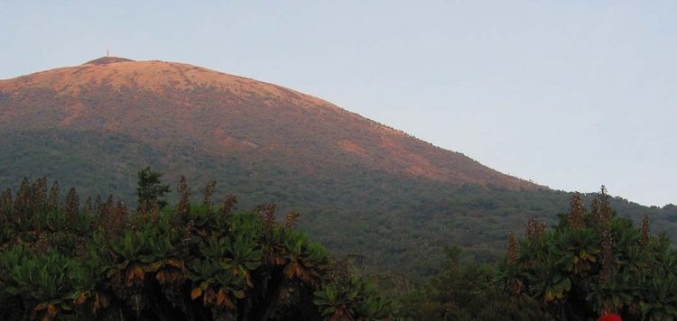
Mountain Karisimbi:The Highest Of The Virungas: It is the highest of all the Virunga volcanoes. Its name in Kinyaruanda means white shell, which refers to its often white-capped summit. It is found in PNV and its the most significant mountain here.
The going is quite steep and good navigation is required not only through the lower slopes, but also on the mountain itself. It consists of secondary jungle and in the most gives an aerie appearance. It is close the the jungle HQ of Dianne Fossey the renowned gorilla expert.
The ascent of Karisimbi (at 4,507m the sixth-highest mountain in Africa, after Kilimanjaro, Mount Kenya, Ruwenzori, Mount Meru (Tanzania) and Ras Dashen in Ethiopia’s Simien Mountains)
The drive from the park office to the trail head is 16 km and takes about 30 minutes to the car park where the road ends. Here you shall meet your porters (who you hire at Rfr5,000 per day and this’ not included in the cost). The climbing starts from about 2,600m ASL.
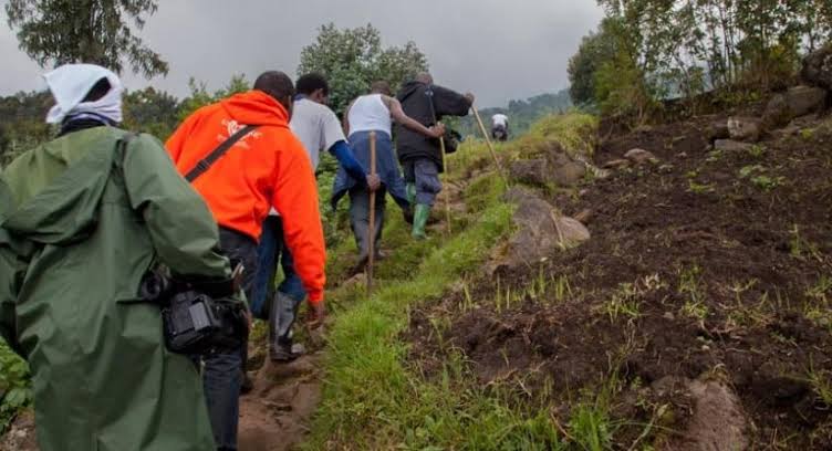
At about 2,067m ASL, you reach close to the Dian Fossey tomb and gorilla graveyards (but visiting would require you pay an extra fee). Your will then traverse different vegetation zones: bamboo and wild celery on the lower slopes, ideal food for Mountain gorillas. Then hagenia forest, with old man’s beard moss on the branches. Then above 3,000m, the marvelous giand groundsel and giant lobelia. Your first camp is at 3,700, a similar altitude to Bisoke, clearly visible behind the camp.
The next day you wake as early as 5:30AM for your breakfast and early departure. The trail gets steeper, much as the fog closes in and ground gets muddy. The terrain gets more tougher here. At about 4,000m, you are above the tree line, the slopes become more exposed and here you need to wear your gloves and hat. After about 2 hours ascent, you start on you last hundreds meters of climbing, walking on volcanic scree (more like grey gravel but not loose). The wind starts getting harder and visibility drops to 25m. Suddenly, you realize you cannot climb the anymore – you are at the summit! The Congolese border is just within a few feet from here. The descent back to the car park takes about 6 hours (including breaks at the camp and the others).
Other Vital Facts:
Best months for climbing : Jan, Feb, Mar, Jul, Aug, Sep, Oct
Volcanic status: Dormant
Year first climbed: 1903
Latitude: -1.5
Longitude: 29.45
Difficulty: Scramble
Elevation (feet): 14787
Elevation (meters): 4507